ArcGIS, QGIS or web apps can simply use this map with web map services. WMTS, TileJSON or XYZ tiles are provided for quick access to processed maps.
Sign in to get links.
Sign in to download GeoTIFF.
Overlay & compare
iiif viewer, iiif info json
Website
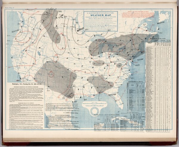
(United States) Weather Map. May 30, 1901.
9734.151
missinglocation
(United States) Weather Map. May 30, 1901. Published by Authority of the Secretary of Agriculture.
1901
U.S. Department of Agriculture, Weather Bureau
58 × 45 cm