ArcGIS, QGIS or web apps can simply use this map with web map services. WMTS, TileJSON or XYZ tiles are provided for quick access to processed maps.
Sign in to get links.
Sign in to download GeoTIFF.
Overlay & compare
iiif viewer, iiif info json
Website
Original viewer
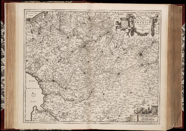
Geographica Artesiae Comitatus tabula / per Nicolaum Visscher edita
0106051036001
1600-1800
Annotatie: Origineel is Blad 35 in atlas factice; Annotatie geografische gegevens: Met 2 schaalstokken; Legenda
1677
Nicolaes Jansz Visscher sr 1618-1679
[Amsterdam : Nicolaes Visscher]
46 × 56 cm
1 : 180000
300