ArcGIS, QGIS or web apps can simply use this map with web map services. WMTS, TileJSON or XYZ tiles are provided for quick access to processed maps.
Sign in to get links.
Sign in to download GeoTIFF.
Overlay & compare
iiif viewer, iiif info json
Website
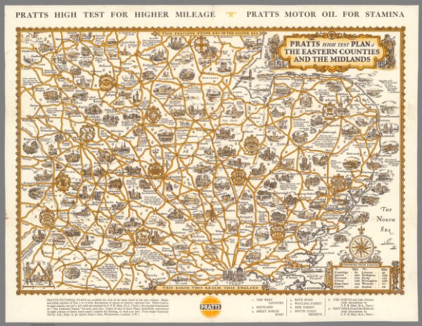
Pratts High Test Plan of the Eastern Counties and the Midlands.
12471.000
missinglocation
1932
Taylor, A.E.
Anglo-American Oil Co. Ltd.
48 × 38 cm
1 : 1100000