ArcGIS, QGIS or web apps can simply use this map with web map services. WMTS, TileJSON or XYZ tiles are provided for quick access to processed maps.
Sign in to get links.
Sign in to download GeoTIFF.
Overlay & compare
iiif viewer, iiif info json
Website
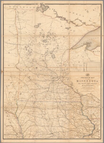
Post Route Map of State of Minnesota.
10440.002
pilot5
Post Route Map of State of Minnesota with Adjacent Parts of Iowa, Nebraska, Dakota, Wisconsin and of the British Possessions (Canada).
1879
United States. Post Office Department
United States Post Office Department
105 × 144 cm
1 : 633600