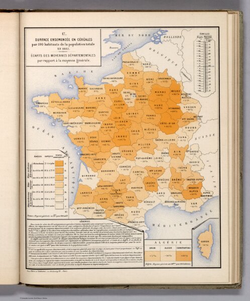
Surface Ensemencee en Cereales par 100 habitants de la population totale en 1882.
ArcGIS, QGIS or web apps can simply
use this map with web map services.
WMTS, TileJSON or XYZ tiles
are provided for quick access to processed maps.
Sign in to get links.