ArcGIS, QGIS or web apps can simply use this map with web map services. WMTS, TileJSON or XYZ tiles are provided for quick access to processed maps.
Sign in to get links.
Sign in to download GeoTIFF.
Overlay & compare
iiif viewer, iiif info json
Website
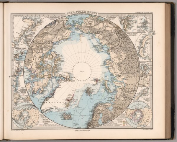
Nord-Polar Karte (Arctic).
2761.017
missinglocation
Stieler's Hand-Atlas No. 10. Nord-Polar Karte. (insets) Various Islands.
1881
Stieler, Adolf
Justus Perthus
43 × 36 cm
1 : 20000000