ArcGIS, QGIS or web apps can simply use this map with web map services. WMTS, TileJSON or XYZ tiles are provided for quick access to processed maps.
Sign in to get links.
Sign in to download GeoTIFF.
Overlay & compare
iiif viewer, iiif info json
Website
11229715903
flickr2
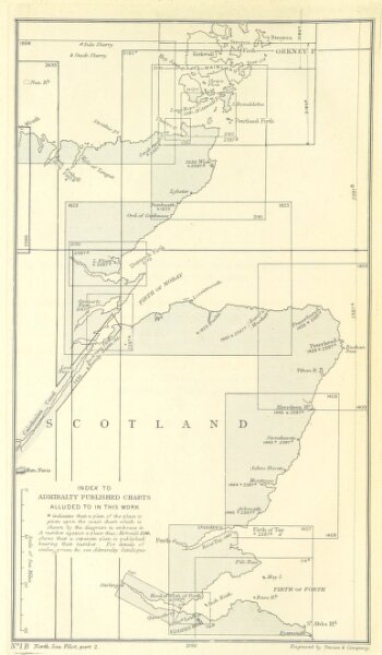
Book: [North Sea Pilot.]
1894
Hydrographic Office
154.7 × 264.7 cm