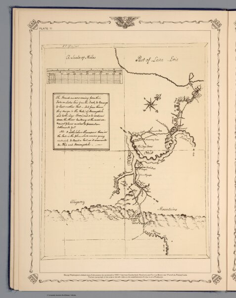
George Washington's sketch map of the county he traveresed in 1753-54 between Cumberland, Maryland, and Fort Le Boeuf, near Waterford, Pennsylvania
ArcGIS, QGIS or web apps can simply
use this map with web map services.
WMTS, TileJSON or XYZ tiles
are provided for quick access to processed maps.
Sign in to get links.